")
")


Bor uzuuriin khuree
Read in Mongolian
Name(s) of Temple :
Bor uzuuriin khuree ,Bodonchiin khuree,
Rinchen Number :
43
Rinchen Name :
Bodonchiin khuree, Gun tolgoin khuree, Dashpuntsaglin
Type of Temple :
Monastic School
Aimag Temple located in :
Khovd
Sum Temple located in :
Altai soum
Old Aimag Name :
Zasagt Khan
Old Sum Name :
Zakhchin khoshuu
Description of location :
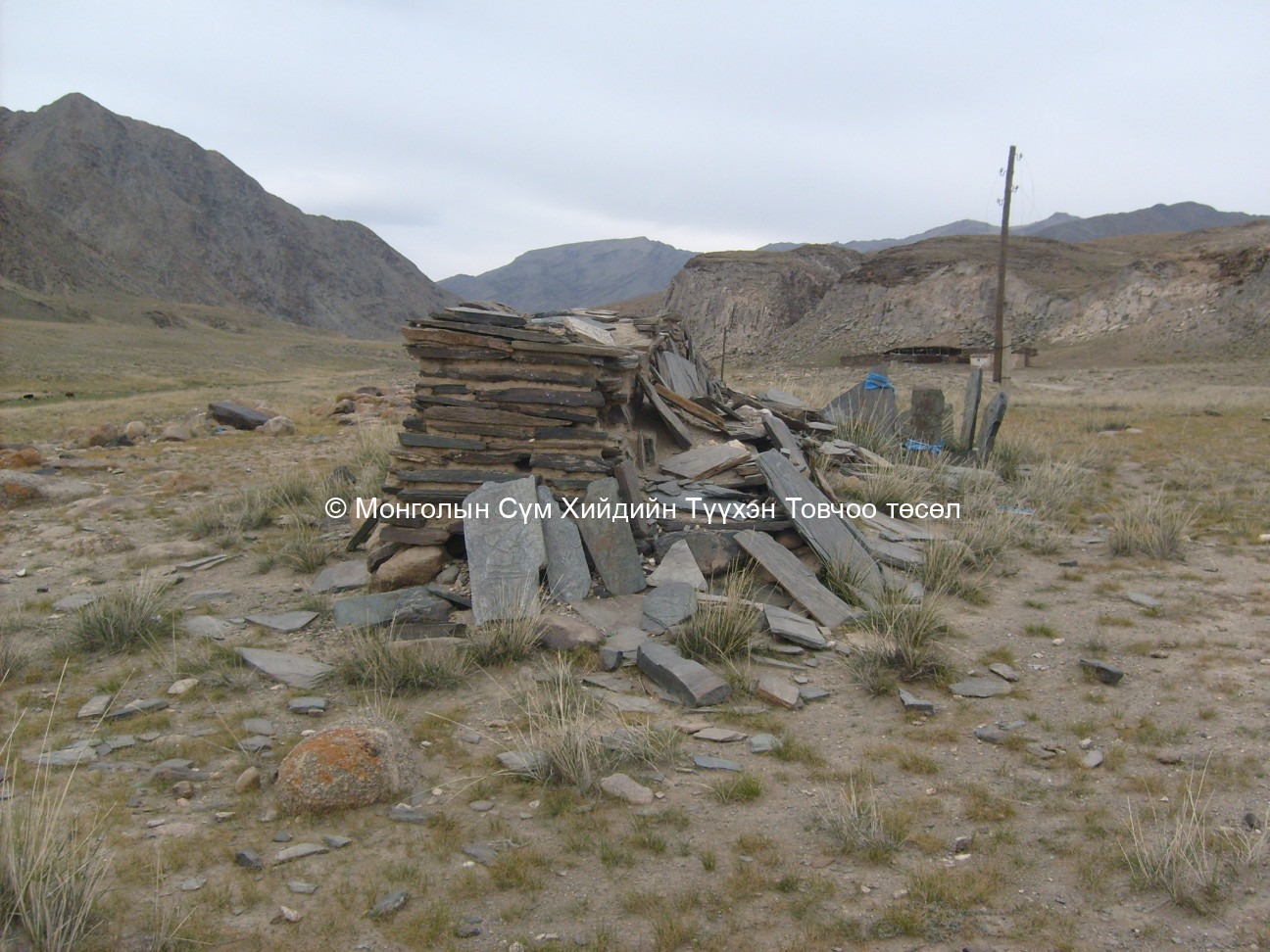
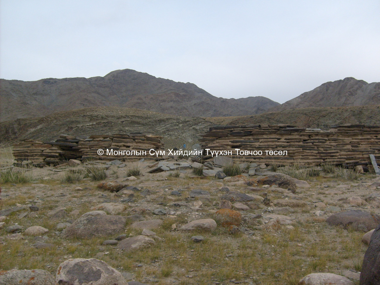
The historic site “Bodonch Monastic city” was located in the Altai Mountain range on the shoreline of Bodonch River which flows through the Mongol Altai Mountain range. The Bodonchiin River streams through a lofty gorge which is surrounded by tall mountains on both sides. The gorge name is Bodonchiin Khavtsal. About 1 km. behind the monastic city base is the Khujirt brigade centre of Must sum. Thus the Bodonch monastic city is at the junction of Altai and Musd sums. The Bodonch river flows to the mouth of the Bodonchiin Khavtsal which also means that the monastic city is in the mouth of the gorge. The geographical name for the monastic city location is the mouth of Nariin in the western mouth of Bodonch Khavtsal. At this location, some families from Altai sum were spending their summer.
GPS readings :
North 45° 48’ East 092° 17’
Revived temple on site :
No
Status of site at time of survey :
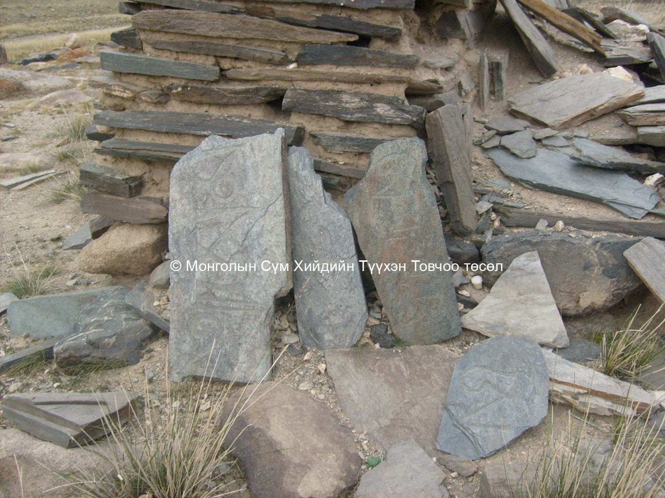
Traces of stones are clearly visible outside the monastic city. These stones possibly made a stone fence that surrounded the monastic city. The stone fence was made from small blue stones and it drew a clean 1 m. wide line with gaps on the right and left hand sides. These gaps are wide enough to be an entrance area. In the middle of the monastic city site are two adjoined, big building bases made from mud. They could be the main Tsogchen Dugan’s bases. In the west, opposite the Tsogchen Dugan base, inside the stone fence, is another building base made from mud. We guess that it could have been a kitchen house. Southeast of the main Tsogchen Dugan is a square stone base and to the south of the stone base is a trace of a well. On both sides of the main Tsogchen Dugan are numerous clear ger bases which were set evenly. The upper side of declining slope of a mountain is dug up to make the surface even and this area was used to set up ger bases. The rim of the ger base is supported by stacked stones to avoid landslide. It is clear that the gers inside the stone fence were home to monks.
Old monastery/temple revived:
No
Үүсгэн байгуулагч хүний нэр болон цол хэргэм (мэдэгдэж байвал):
Date of Reviving:
Monks in Old Temple :
100 monks
50 monks
100 monks
50 monks
Notes :
Additional notes:
1,2. The location of the site “Bodonch Monastic City” – Gun Tolgoin Khuruu – Dashpuntsaglin is written as occupying the Altai Sum centre in the list of Pro. B. Rinchen. However, our team has located the monastic city near the mouth of Bodonch Khavtsal and did not have any notes of the previous establishment of this monastic city. The locals gave us the information that the Bodonchiin Khuree of the Zakhchin Barren was located at the above-mentioned location. Based on this information, the Bodonch Monastic City was moved to the mouth of the gorge or Gun Tolgoi area on which Altai sum centre was later established.
7. Our team measured the stone fence that encloses the monastic city and the two adjoining building bases. On the site are about 30 ger bases which have average diameters of 3.5 to 4 m. and about 3 small bases which measure 2 – 3 m.
11-13. An historical record suggests that the Bodonch Monastic city was built at the beginning of 19th century and around 1937 – 1938 the monastic city’s 289 monks were counted and shot dead. Locals confirm the monastic site was once home to more than 500 monks.
Form Number :
ХОАТ 102
Survey Team :
Team А